- About us
- Research expertise
- DIGITAL – Institut für Digitale Technologien
- MATERIALS – Institut für Sensorik, Photonik und Fertigungstechnologien
- ROBOTICS – Institut für Robotik und Flexible Produktion
- COREMED – Zentrum für Regenerative Medizin und Präzisionsmedizin
- HEALTH – Institut für Biomedizinische Forschung und Technologien
- LIFE – Institut für Klima, Energiesysteme und Gesellschaft
- POLICIES – Institut für Wirtschafts-, Sozial und Innovationsforschung
- Business areas
- Products & services
- Research infrastructure
- Beteiligungen
- Career
- Aktuelles
- Publications
- Kontakt zu uns

Mobile mapping platforms
High-precision 3D measurement systems enable the research and implementation of innovative solutions for the automated creation of digital twins.
Our nationally unique research infrastructure is capable of producing spatial digital twins. Vehicle-based, airborne and terrestrial laser scanners are used for high-precision surveying of the environment to generate output data for automated derivation of digital images of reality, 3D models and high-precision reference maps (UHDmaps®).
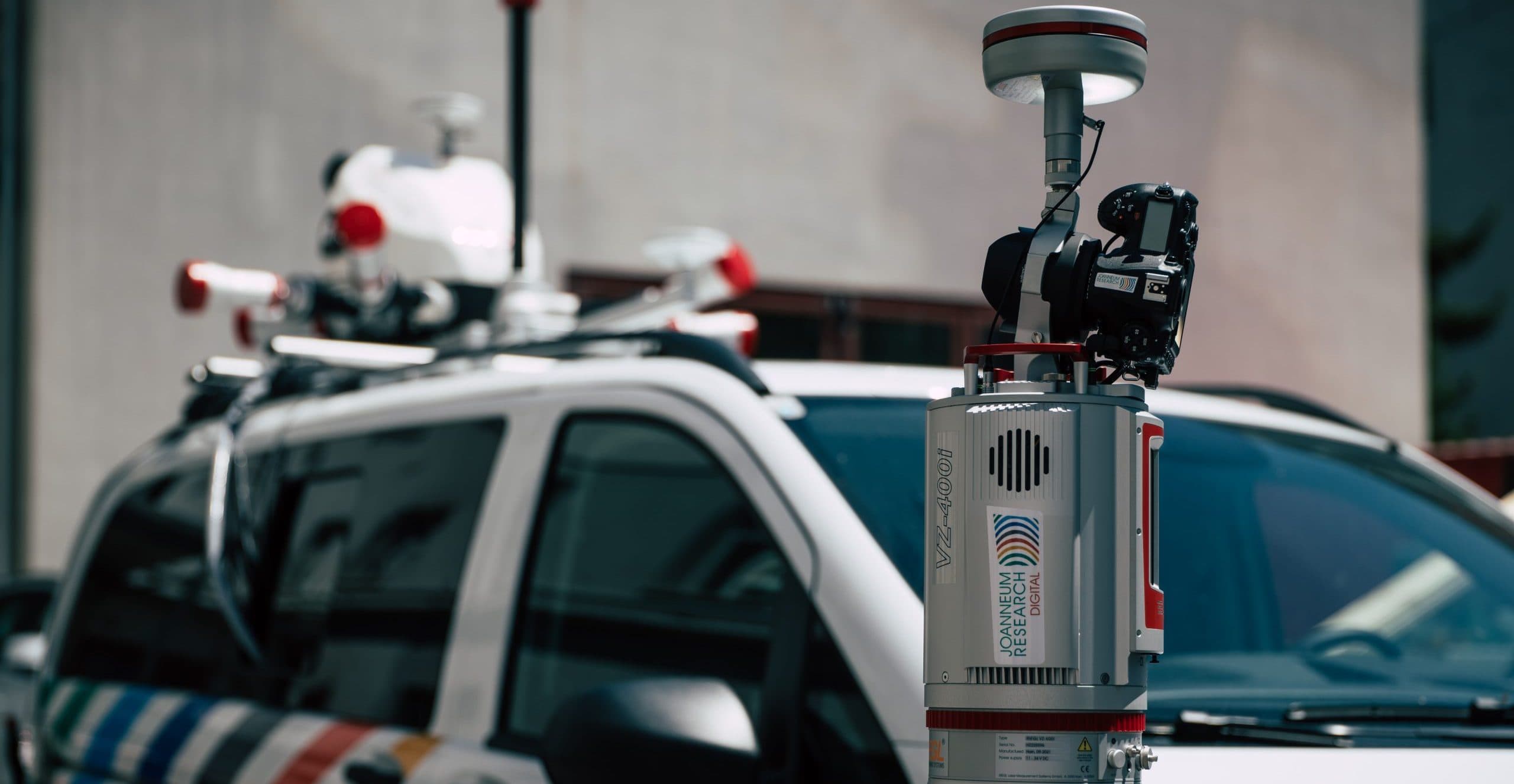
Body on the vehicle
The Riegl VMX-2HA is the latest generation of RIEGL's vehicle-based mobile mapping system. It is used on a measuring vehicle to measure the road surface with millimetre accuracy. Two laser scanners record 3.6 million measurement points per second, 7 cameras and a panoramic camera can record 114 megapixels.
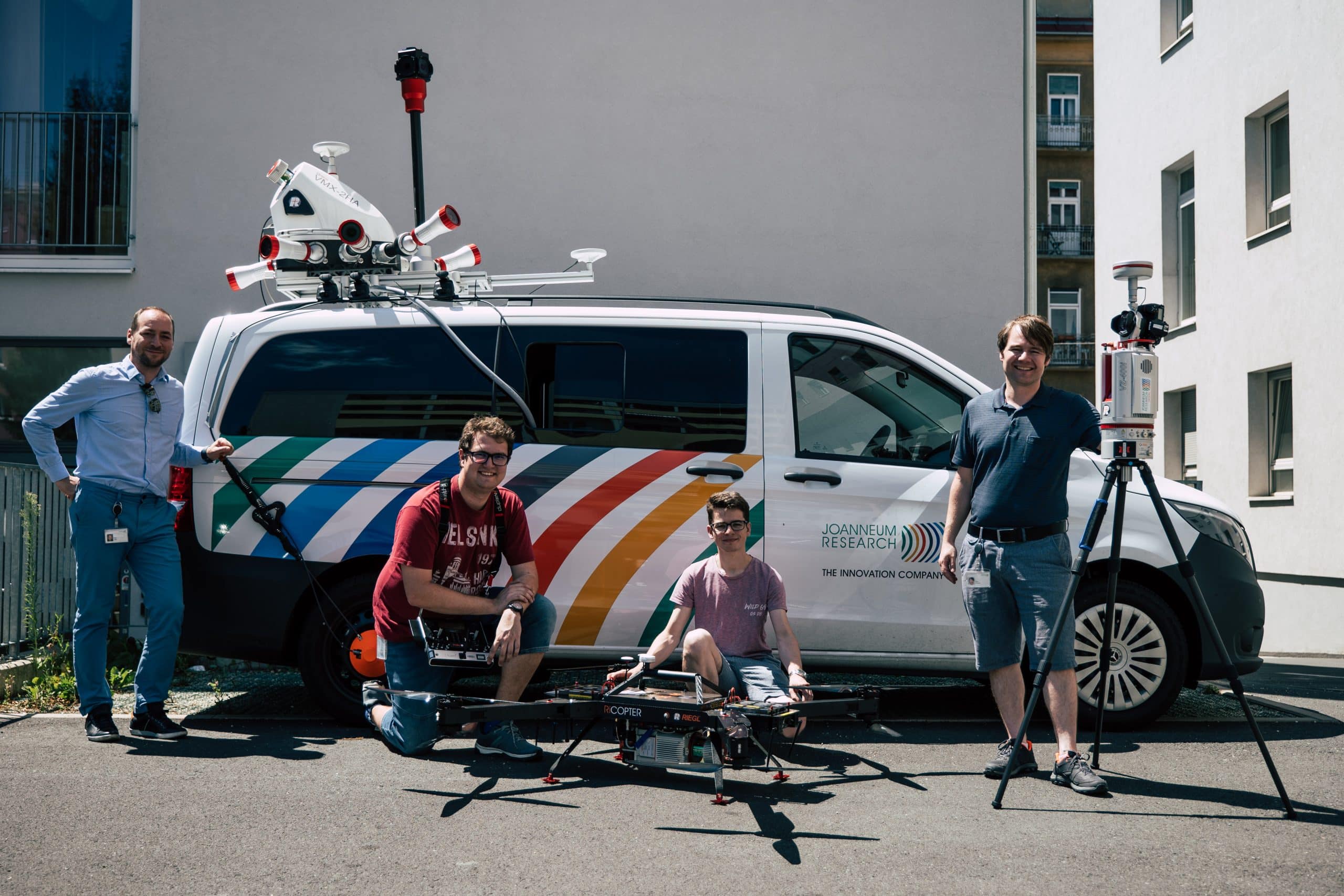
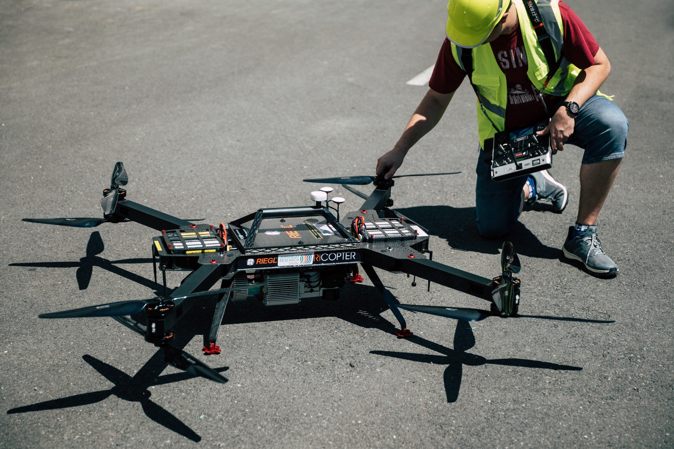
Survey drones
The drone is a fully integrated system for UAV-based surveying tasks. With a weight of 11 kg and a payload capacity of 7 kg, it can carry a laser scanner, an optical camera and a thermal camera, and can cover 2 km² per flight.
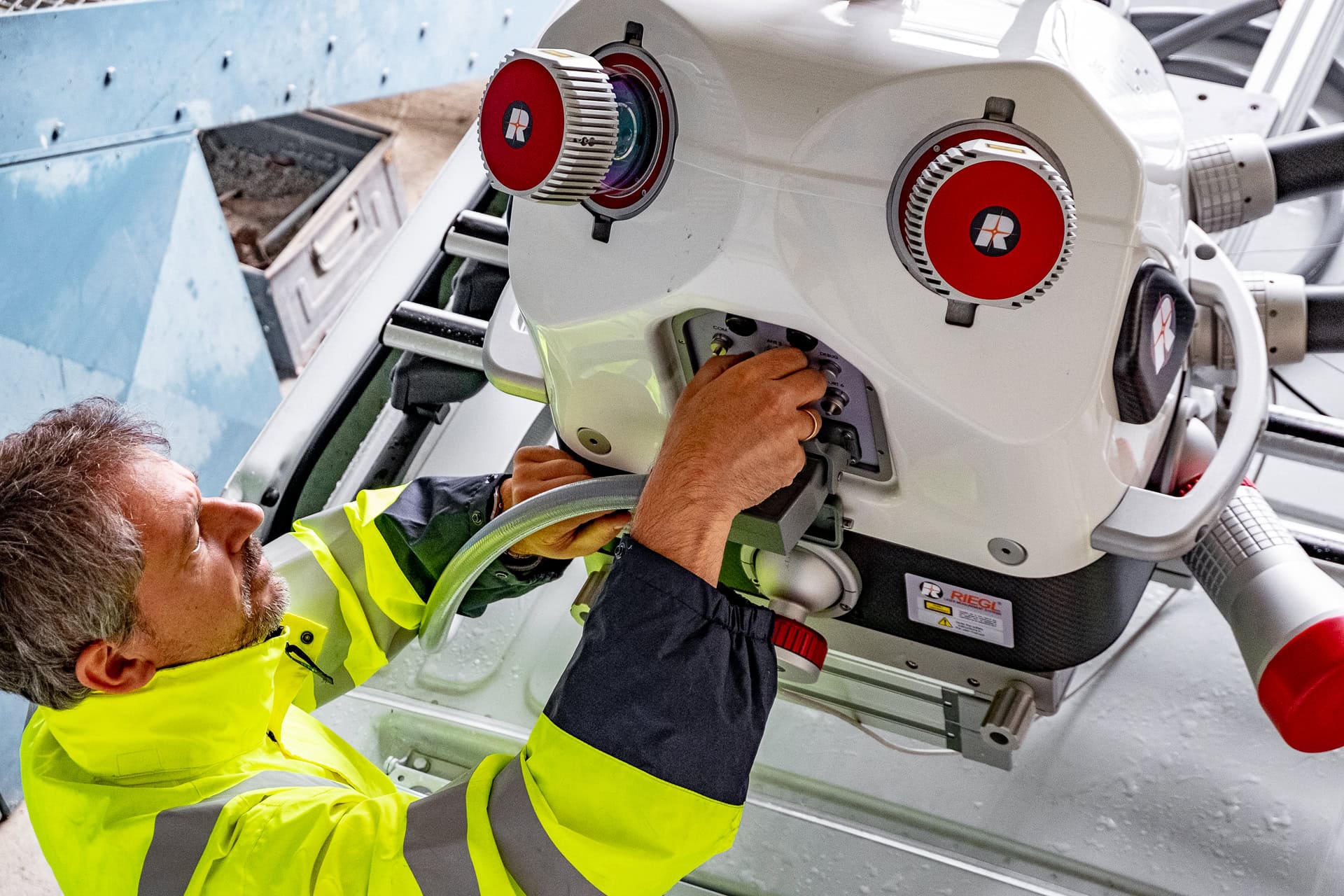
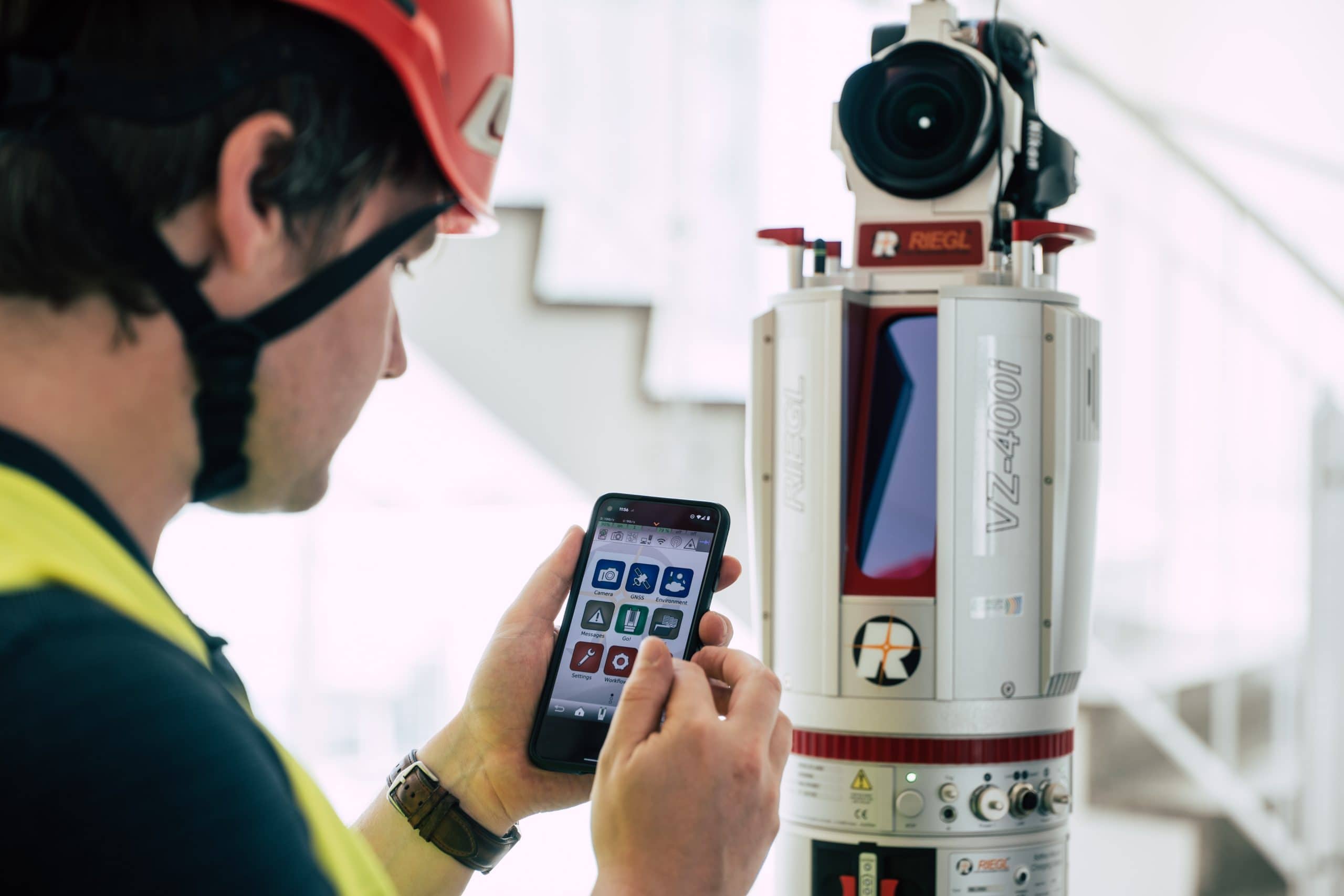
Terrestrial laser scanner laser scanner
Our state-of-the-art 3D laser scanning system combines the simultaneous acquisition of scan and image data with a special processing architecture. The system provides advanced signal processing (waveform processing, multi-target capability), automatic on-board registration and georeferencing using RTK-based positioning.
Mobile laser scanner
The Viametris MS-96 is a modular, mobile laser scanning system for indoor and outdoor surveys that can be used in a backpack or vehicle configuration. It consists of a panoramic camera combined with two LiDARs capable of capturing up to 960,000 points/sec. A GNSS receiver with a high performance IMU enables the implementation of SLAM techniques.

Your contact
Location
Das sagen unsere Kunden
Additional research infrastructure
DIGITAL has a hearing laboratory equipped to international standards (ITU-R BS 1116-1).
We develop innovative software and hardware solutions for satellite radio.
We carry out experiments in optical metrology, optical spectroscopy and machine vision.
For innovative satellite communications, our infrastructure includes antennas in the Q/V band (40/50 GHz) and W band (71-76 GHz).
The laboratory combines state-of-the-art measurement technology with intelligent analysis software for prototype development and human factors and ergonomics studies.
The IoT Innovation Space is both a physical and virtual space to help you achieve digital transformation with design thinking, IoT and AI.
In our AI Lab, we provide human and computational resources for research and development of state-of-the-art AI (neural network) models.
SHAPING THE FUTURE, TOGETHER
JOANNEUM RESEARCH provides innovation and technology services in the field of applied research. As a research company working on behalf of various federal provinces and regions in Austria, our expertise shapes the development of our modern society and economy – sustainably, and always with a focus on people. As a multidisciplinary team working in a flexible set-up that fosters innovation, we always live up to the highest social and scientific standards.