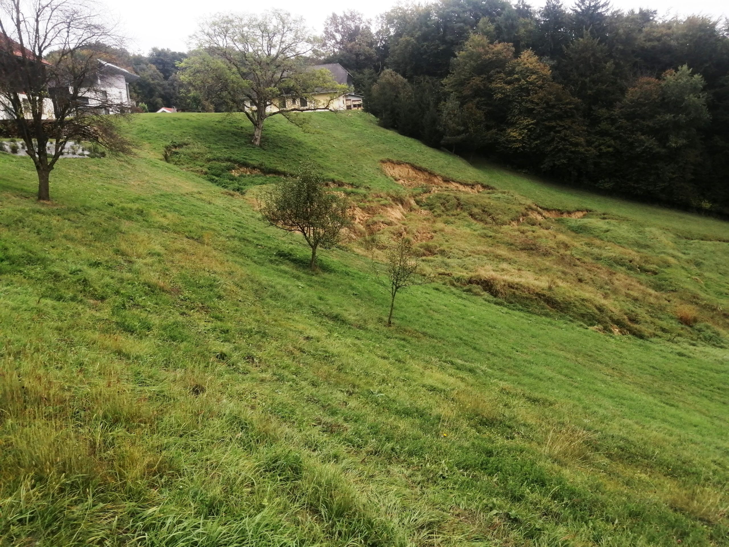
The storms of recent weeks have taken their toll on the Styrian landscape. Squalls, thunderstorms and persistent heavy rain have caused flooding and massive landslides in the Graz area and eastern Styria. The Styrian civil protection agency reports that households are still cut off from the outside world and that massive infrastructure restrictions are still expected in the affected areas. It is still unclear how long the clean-up will take.
Such natural disasters cannot be completely prevented, but we can be better prepared for them and take measures to minimise the consequences and damage. Another important step is to raise awareness among the authorities and the population that natural hazards in Austria are not limited to the Alpine region, but are increasingly causing restrictions and damage in hilly areas outside the Alps as well.
Our environment is currently undergoing many dynamic changes, with climate change, the increasing frequency of extreme events and increased demands on land use at the forefront.
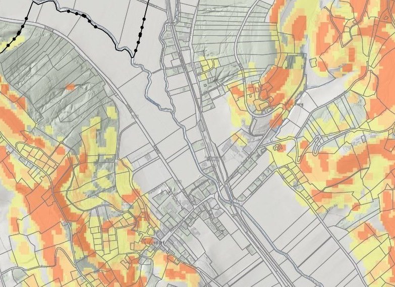
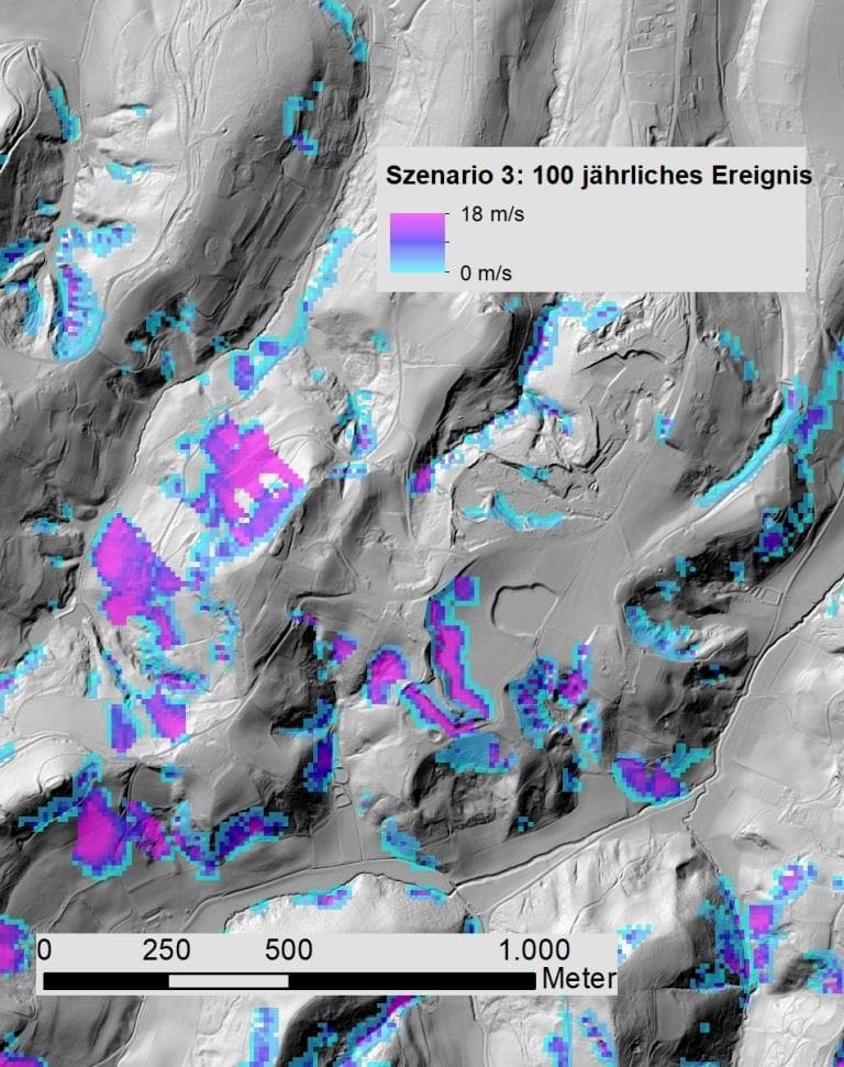
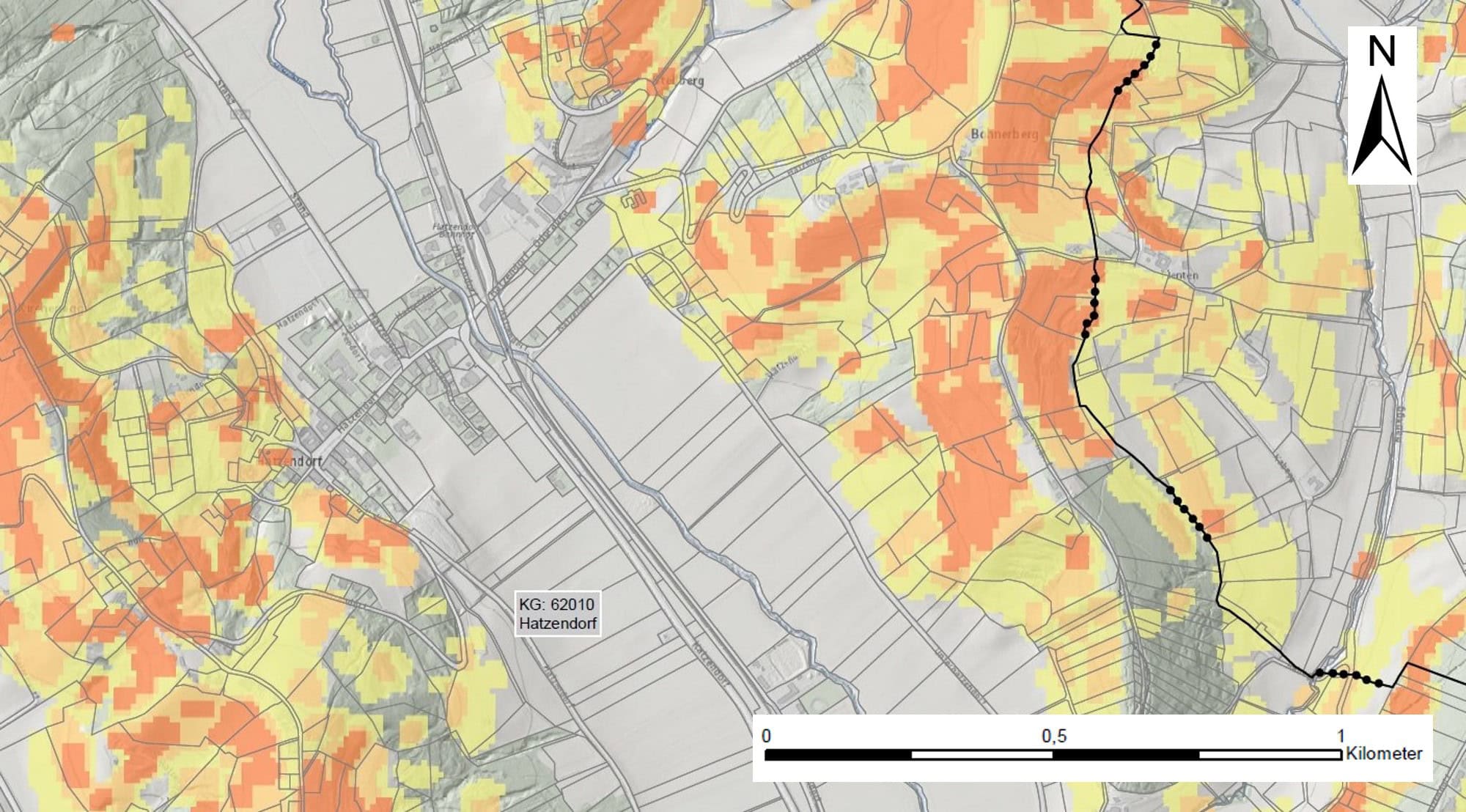
The DIGITAL Institute creates hazard maps
The research approaches of JOANNEUM RESEARCH DIGITAL are based on the use of innovative remote sensing data and their combination with terrestrially collected data. We use these data, for example, to model the probability of occurrence of mass movements and their potential range. The information systems based on these data are a tool for local authorities and infrastructure operators in particular to take account of hazards in spatial planning and to identify the need for protective measures (creation of so-called hazard maps). Regular updating of the input data ensures that dynamic environmental changes are also taken into account.
Our expert Herwig Proske from the research group Remote Sensing and Geoinformation was a guest on ORF III on 15.06.2024 to talk about the dangers of landslides in Styria! To the interview in German.